Category Archives: Bradford

Rev. Godfrey Wright – who he?

new-doc_2

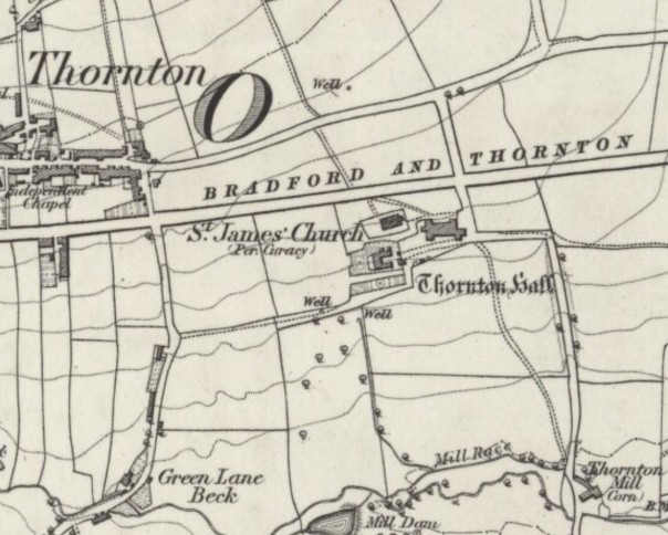
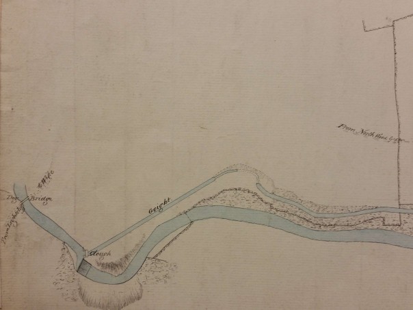
This beautiful map from the Bradford Local Studies Library is of Askwith, a village between Ilkley and Otley but north of the Wharfe valley. Today it is in North Yorkshire, just over the border from West Yorkshire. The different colours are used to designate the fields of several tenant farmers but the landowner is one Godfrey Wright. Stylistically this looks like a late eighteenth or early nineteenth century map; as you will read 1805-06 would be a plausible date. Rev. Godfrey Charles Wright (1780-1862) owned land all over Bradford and district in the mid-nineteenth century. You will see his name in central Bradford, Horton, Manningham, Baildon, and elsewhere. This map does not employ his title which also suggests an early, pre-ordination, date. Wright does not seem to have lived in Bradford for any prolonged period, if at all. Certainly by 1822 he resided at Bilham House, Hooton Pagnell, South Yorks where he stayed for the next 40 years. In census reports he describes himself as ‘clergyman without cure of souls’ and has an indoor and outdoor staff of a dozen or more. He appears in newspaper reports subscribing to Leeds Infirmary and Bradford Infirmary, and is a member of the Camden Society with, presumably, an interest in ancient history. He left a substantial fortune at his death but how did he acquire all his property?

Victorian Bradford historian William Cudworth, and modern historian Astrid Hanson (author of Sharp to Blunt), agree that Godfrey Wright’s wealth essentially resulted from an ancestral relationship with three local families, the Swaines, Fields and the Booths. That there was such a connection is certain since Wright used all three surnames as his own sons’ middle names, and a collection of Wright papers in the West Yorkshire Archives contains much material relating to Swaines and Booths. Both the authors mentioned believed that he also benefited indirectly from the estate of Abraham Sharp of Horton Hall, the famous mathematician. This is definitely true but I am less certain about the extent of this inheritance. At present I am also uncertain whether Wright inherited the bulk of his property on a single occasion, or benefited from multiple bequests as distant relatives died without direct descendants, ‘heirs of the body’ as they would be termed in old wills. There can be no doubt that, however he acquired them, his fields and cottages in his possession became vastly more valuable as space in Bradford itself became increasingly necessary for new roads, mills, dwellings and public buildings. Godfrey Wright owned the land on which Little Germany and St George’s Hall were eventually built for example. He and his estate reaped an enormous fortune from the prosperity of the borough, a fact that evidently occurred to his contemporaries. He left £80,000 at his death in 1862 which equates, according to the National Archives currency converter, to £3,452,800 in 2005 values.

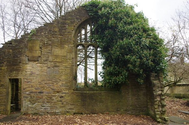
There is a Swain (sic) tablet in Bradford cathedral. It commemorates William Swain of Bradford and his family. I think it is reasonable to assume that only wealthy families of some consequence had commemorative tablets inside the Parish Church. The monument was erected by Mary and Elizabeth Swain, co-heiresses of the family:

William Swain d.1737 aged 71

Son, William d.1715 aged 20

Son, Abraham d.1732 aged 34

Abraham Swain (brother of elder William) d.1731 aged 58

Son, Abraham d.1733 aged 28

Mary seemingly stayed single but Elizabeth was to make a significant marriage. Cudworth also mentions a ‘Dr Swaine of Hall Ings’ who was an eminent apothecary and a friend of Abraham Sharp whom shall soon meet for a third time.

George II became king in 1727. The following year, according to a West Yorkshire Archives indenture, two spinsters Elizabeth & Beatrix Field (daughters of William Field ‘late of Bradford’) are involved financially with an Abraham Swaine. He is possibly the elder man of this name on the Parish Church tablet. The document mentions a great many fields, barns and dwellings. Some familiar place names are: Goodmansend, Silbridge and Penny Oak all in Bradford. One dwelling is occupied by ‘the widow Beatrix Field’ who is likely I suppose to be the girls’ mother. The indenture talks about the Field girls paying a ‘fine’ but I’m not certain exactly what was involved nor why. It may not matter as we shall see. Clearly the Field family must also be linked to Godfrey Wright if their family papers ended up in his archive.

Remember the two Swaine girls, Mary & Elizabeth? Mary Swaine may be an ‘Aunt Swaine’, who lived in Hall Ings dying in 1759. Mary’s sister Elizabeth Swaine married Rev Charles Booth I, who died in April 1761. They had a number of children including Charles Booth II who was born in 1734. Fortunately the will of Rev Charles Booth I also survives in the West Yorkshire Achives. Among the legal language there are three important facts: Rev Charles Booth I was a wealthy man himself with much cash and property. Sarah & Beatrix Booth were his only surviving daughters who were left £500-£1000 each, which would be many hundreds of thousands of pounds in modern money. Finally Charles Booth II was his only surviving son and was executor, land inheritor and residuary legatee. The lands were in the parishes of Halifax and Bradford although the only names I am certain about are Ovenden and, I am glad to say, Askwith.

Charles Booth II evolved into a wealthy young barrister. He changed his name to Charles Swaine Booth after inheriting more property from his ‘aunt’ who I assume was Mary Swaine of Hall Ings. I believe that by this means he obtained the whole of the Booth and Swaine inheritance but he had one more piece of financial luck, and one more name change, to come. A lady called Hannah Gilpin changed her name to Hannah Gilpin Sharp in 1767. Essentially she had inherited Abraham Sharp’s estate via his niece Faith Sawrey. Abraham Sharp was a mathematician and scientist and he lived and worked at Horton Hall. Abraham’s estate passed to his niece who had married Robert Stansfield of Esholt. Their daughter, Faith, married Richard Gilpin Sawrey in 1722 but died in 1767 without children. Faith Sawrey left her estate to Hannah Gilpin who was probably related to Mrs Sawrey’s husband in some way. Latterly Hannah had lived together with Mrs Sawrey.

As you may have guessed Charles Swaine Booth married Hannah Gilpin Sharp, in 1769. The couple lived together at Horton Old Hall under their final names of: Charles SB Sharp (1734-1805) & Hannah Gilpin Sharp (1743-1823). Presumably the new Charles Sharp would have acquired control of his new wife’s considerable property. I don’t know enough about contemporary legal affairs to know whether some was entailed to accompany the Hall, or whether the marriage contract would have reserved certain properties to his wife. Charles Sharp died in 1805. At that time he had no living brothers or children and was clearly in need of an heir. He seems to have left property to his sisters Sarah & Beatrix but both were seemingly dead by 1811. Control of the inheritance was passed to Gordfrey Wright although on the face of it he was rather distant relative. The closest common ancestor would seem to be the Rev Marmaduke Drake, a vicar in Derbyshire, who was Godfrey Wright’s great grandfather.

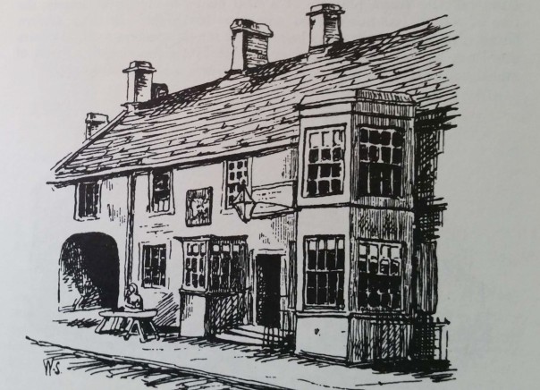
Godfrey Wright had been born in 1780 at Kimberworth, Rotherham and educated at Hipperholme GS (like Sir Robert Peel) and Trinity College, Cambridge 1799 (MA 1807). I don’t know the exact year of his ordination but he married in 1812, at Huddersfield, Mary (1790-1821) daughter of Henry Stables & Penelope Greenwood. His wife died at Bath in 1821. Wright was already described as ‘of Bilham House’ at that time. He frequently visited Bath, York & London for the season according to contemporary newspapers. In the mid 1800s his agent was Thomas Hirst of Hall Ings, Bradford. Wright was involved in a legal action, Rawson v. Wright, an action brought by the Ladies of the Manor against him for the erection of the Waterloo market in Hall Ings (Charles St) in 1825: they won. He was involved in some controversy over paving Hall Ings in 1835. In 1850 he owned the land on which a public hall (St George’s) was built and got £15,000 for it (Bradford Observer October 17 1850). The Bradford Observer February 26 1857 said that he owned The Beehive Inn and other ‘low’ dwellings in the Silbridge Road area (The Beehive estate was eventually purchased from his trustees for £5,775 in 1864).

Cudworth states that Hannah Gilpin Sharp (aka Madam Sharp) long outlived her husband finally dying in 1823. Godfrey Wright didn’t inherit all the Sharp property although he was executor of and beneficiary from Hannah Gilpin Sharp’s will. She bequeathed the mansion at Horton, with all her estates in Bradford and elsewhere, to her nephew, Captain Thomas Gilpin, and his male heirs, and in default of issue to her niece, Ann Kitchen, widow of Major Kitchen, and her heirs. Captain Gilpin, after enjoying the estates three years only, died at Madeira in the year 1826, without having been married, whereupon Ann Kitchen came to the property, and married in 1828 Mr. Edward Giles, a clerk in Somerset House, for her second husband, who died in 1832. The property extended over many portions of Horton, including that fringing both sides of Horton Lane. Estates of ‘Mrs Giles’ are also common on maps of Bradford and Horton. She died at the age of 80 and is buried in Bradford PC. When it comes to nineteenth century property you might do well simply for being a survivor, but there were many slips betwixt cup and lip.

Thornton Bell Chapel

imgp4796

Thornton is a delightful old township outside Bradford whose moment of fame came in 1815 when Patrick Bronte was appointed its perpetual curate. Charlotte, Emily and Anne, together with their brother Branwell, were actually born in Thornton as a local plaque reminds visitors. For some reason it has never attracted the tourists in the way that Haworth has, although Thornton has many beautiful eighteenth and nineteenth vernacular buildings which are well worth visiting. Those interested in industrial archaeology will be drawn to its tremendous railway viaduct, built by John Rowlands, across which you can now walk. If you live anywhere near Thornton I can thoroughly recommend a visit.

The parish church of St James is a late Victorian construction (1872) which has a permanent exhibition of Bronte memorabilia. Patrick Bronte’s own church, where the four children were baptised, is now a ruin across the main road as you can see from the first image. Many local people have worked very hard to maintain the remains in a fit state for inspection. Please look at their website:

http://www.brontebellchapel.co.uk/

For most of its life the chapel was also officially dedicated to St James but it is widely known as the Bell Chapel which is the name I will employ. In the past it functioned as a ‘chapel of ease’ for Bradford parish church (now Bradford Cathedral) along with similar chapels at Haworth & Wibsey. People from Thornton itself worshipped there but also their neighbours from Wilsden, Clayton, and Allerton. Today only the east end of the original building remains, together with a stone cupola which was added to the Bell Chapel in 1818. At that time the chapel was also re-fronted on south side and re-roofed. It was said to have been ‘beautified’ in this way by Patrick Bronte who left Thornton for Haworth two years later. The areas both within and outside the chapel ruins are covered by many beautifully cut grave-stones. Among the internal monuments are those to members of the Firth family. Elizabeth Firth of Kipping House, Thornton, was godmother to some of the Bronte children. On my first visit my attention was caught by a series of date stones incorporated into the standing east wall. These are probably not in their original positions but ostensibly indicate the dates: 1587, 1612 and 1756. These stones puzzle me, but it might first be worth looking at what the two great nineteenth century Bradford historians have to say on the subject of the Bell Chapel.

John James (1841) notes that at the western end of the building was the 1612 inscription. Did he mistake his compass points or is this statement evidence of its re-positioning? He also mentions the 1587 stone which he supposes is when the most ancient part of the present chapel was built. He notes the existence of a chapel bell dated 1664, and the fact that in 1678 chapel registers commence. James noted that substantial work was done in 1756. The roof was taken off, the north side wall was demolished, and the west end wall demolished to within a yard of the ground. The south & east walls were also rebuilt. In 1793 the pews were repaired and a gallery for an organ loft erected. Even after Patrick Bronte’s work in 1818 the chapel was ‘considerably altered and repaired’.

William Cudworth, writing at the end of the nineteenth century, states that there was no pre-reformation church on the site. He also noticed the date stones and inscriptions which he must have seen in the same form as they are today. He describes how the chapel had seating for 600, which is a little hard to believe, since by his own account the Bell Chapel was low, dark and damp! He generally accepts James’ dates, and may well have used the earlier historian as a source of information.

thornton-bell-1851

The first OS map of the area, surveyed in the late 1840s, shows the chapel and the nearby Thornton Hall. Neither building is aligned on the Bradford & Thornton Trust turnpike which was 20 years old at most. Did Charlotte have the hall in mind when she described Thornfield Hall in Jane Eyre? The hall is said to have been rebuilt in stone in 1598 when owned by the Tempest family, and then extensively renovated in the late nineteenth century by the then owner, John Foster of Black Dyke Mills fame. Thornton is a good place for seeing date stones. They must always be treated with some care since they can be moved from an older building, or carved with a year which pre-dates the erection of the stone. The oldest at the chapel site is of 1587, the year before the Spanish Armada. There is nothing impossible about the date which fits well with the work on nearby Thornton Hall. I’m simply puzzled that the stone carver seems to have used three different fonts for the numerals 1 & 8, 5 and 7. It’s not impossible of course that the masons involved were given the privilege of carving a numeral each. The 1756 date fits well with the eighteenth century work on the chapel. The carving just looks a little amateurish when compared with contemporary date stones in Thornton itself.

imgp4795-2

The 1612 inscription is beautifully carved and has been universally accepted as accurate. It would certainly seem to indicate that the chapel was built or rebuilt by a freemason in that year. Yet there are several puzzles. Firstly 1612 seems an early year for English freemasonry. The Freemasons themselves state that their early history is a subject of speculation. The United Grand Lodge was founded in 1717 and the earliest date for an English freemason that I can locate at present is Elias Ashmole in 1646. The task of identifying the builder would be a great deal easier if the name was still present but this has been obliterated for no reason now known. Finally the technique of the inscription is essentially that of the cameo. The surrounding stone is removed to reveal the lettering in relief. This is a far more difficult than simply carving the lettering and does not, in my judgement, produce a particularly beautiful result. The technique has been adopted for the dates in a local tombstone, and I have been trying to compare the letter forms with other local seventeenth century stone inscriptions. The bar over the capital A is one such peculiarity and the V replacing the harder to carve U is another. The Ys that look almost lower case would also fit although I cannot yet match the ligature between the H & E or the final E in LORDE.

imgp4802-2

So can anybody help me? Is this inscription truly from the year 1612? If it were carved a century later with a spuriously early date I would be less puzzled, but I may be quite wrong to be suspicious. A comment from a historian of English Freemasonry would be especially welcome.

Bradford’s German quarter

20161204_150059

The district known as Little Germany is close to Bradford Cathedral. It is famous for a large collection of magnificent Victorian textile warehouses. In many cases their creators were German merchants, which gave the area its name. The pictured building was originally the premises of Thornton, Homan & Co. They traded with the US, hence the eagle over the door. In 1977 John S Roberts produced an invaluable short pamphlet entitled Little Germany which is full of essential information. Roberts explained that most of the building occurred in the period 1860-67. I have been researching the earlier history of this part of Bradford. On an 1800 map it was simply a green field site. Fortunately Church Bank and Vicar Lane have retained their names since that period which makes the placement of this area on modern maps easier. Immediately south of this area is Leeds Road which originally formed part of the Leeds-Halifax turnpike created in the late 1820s or early 1830s.

new-doc-3_2

The Bradford Local Studies Library has this plan of the piece of land which is now the lower part of Little Germany. This map is annotated on the back as ‘Colliers Close’. I have found no other record of this name but it is perfectly credible since coal was mined all over the city. In fact Roberts reports that building on some of the Little Germany sites was difficult because of old mine workings. A huge help in dating this plan is that Bradford is referred to as a Borough, a status only achieved in 1847. On the other hand the first OS map of the area, which was issued in 1851 and surveyed in the late 1840s, shows no sign of any new street development. If we said that this plan was from 1848-49 I do not suppose we should be far wrong. It is interesting to note the location of two smithys and a joiner’s workshop. So, to recap, in the 50 years since the green fields of 1800 the area was mined for coal, transected by a major road, and was the site of small necessary businesses. The first Bradford Mechanics Institute, just visible at the bottom right, was founded in 1832. Leeds Road on the plan, confusingly, is not the major route of that name but a short branch that was soon renamed Well Street. The name Lee Street was soon changed to Currer Street but there is a pencil annotation describing it as ‘Abram Street’ as well. Field Street seems to have been so named originally and retains its name today.

The land-owner at this time was Rev. Godfrey Wright (1780-1862) who seems to have possessed land all over Bradford and district in the mid-19th century. He was born at Kimberworth and was educated at Hipperholme School and Trinity College, Cambridge. He obtained an MA in 1807 and later took Holy Orders. His address was Bilham House, Hooton Pagnell. S.Yorks. In census returns he describes himself as ‘Clergyman without cure of souls’; he reports an indoor and outdoor staff of a dozen or more and must surely have lived in some style. Wright left £80,000 at his death. I have learned a good deal about him but two questions remain. Firstly did he ever actually live in Bradford and if so where and under what circumstances did he become such a prodigious land-owner? He certainly was the largest in Bradford having land in: Baildon, Otley, Eldwick, Manningham, Bowling and Hall Ings as well as the future Little Germany. He is said to have inherited it, but from whom?

The people that the second map records as new owners do not seem to be the same as those who built the famous Little Germany warehouses 10-20 years later. There are several interesting individuals nonetheless. Augustus Silvestro (AS) Sichel were a Manchester textile firm. Augustus’s son, Sylvester Emil Sichel, later lived at Shipley Grange. As early as 1856 Sichel Bros were trading in Well Street. I’m not sure what their relationship was with Victor Sichel, manager of Reiss Brothers yarn and stuff merchants in Currer Street. Victor was the father of the Bradford artist Ernest Sichel (1862-1941). Both familiies originated in Frankfort am Main, Germany. Thomas Mills was a Bradford furniture merchant and upholsterer. Thomas Fison was in the partnership of Fison & Lister, wool merchants at Well Street.

Nicholas Hermann Heydemann (1817-89) was both a cloth merchant and German Consul. He is buried at Undercliffe cemetry. In 1859, on his land at 4 Currer Street, the premises of Nathan Reichenheim, yarn merchants, was constructed. This is probably the oldest of the surviving buildings. In 1874 on GB Smith’s site at the junction of Field Street and Vicar Lane Law Russell’s opulent Victorian warehouse was erected.  It is a fitting memorial to Bradford contractor Archibald Neill who died soon after. Both the mentioned buildings were designed by local architects Lockwood & Mawson. The Borough Map of 1871 shows the area almost completely filled. I imagine that by 1875 the appearance was very much as it is today.

20161204_150027

A city pub: the Bull’s Head Inn, Westgate


new-doc-1_2

As you may have gathered I am a map enthusiast, but it is a rare pleasure to be able to match a plan with a surviving drawing. William Scruton, in his Pen & Pencil Pictures of Old Bradford, includes a picture of the above establishment: The Bull’s Head Inn, Westgate. You can just make out the bull’s head on the tavern sign. Scruton’s book was published in 1889 although this cannot have been the date of the original drawing since by 1886 the inn was no longer in existence. But in its day it had an important place in the history of Bradford.

Scruton says that at one time in front of this inn was a bull ring for bull-baiting, which presumably provided the name. Close-by was the town pillory in which offenders were manacled while being subject to the abuse of passers-by who hurled eggs or fruit at them. Under the influence of the more enlightened the pillory was outlawed in 1830 and bull-baiting in 1835. I have seen a watercolour print which places the pillory on a wooden stage just about where the figure is sitting. The Victorian historian William Cudworth, in his account, doesn’t mention ball-baiting but says that in front of the inn was a market with rows of butchers’ stalls; another possible source for the name then. Whatever the truth there’s not much doubt that Scruton was thinking of the situation in the late eighteenth century. At that time the inn was used by merchants, manufacturers and woolstaplers. The first Bradford Club was founded there, according to Cudworth, in 1760. By the early nineteenth century a Mrs Duckitt was the host. She was apparently famous for her rum punch, which sadly isn’t a beverage that I have ever tried. An Act of Parliament in 1805 appointed commissioners for levying rates and improving Bradford roads and lighting. These commissioners, a sort of primitive town council, met at the Bull’s Head. In some ways it was our first Town Hall. Apparently 60 years before Scruton’s book was published, which would be in the 1830s, the inn was also a rendezvous for town and country musicians.

Inns are usually easy to trace in trade directories and newspapers like the The Bradford Observer. I only wish I had more time for a detailed study. The 1818 and 1822 commercial directories place Jeremiah Illingworth in charge at the Bull’s Head. It seems to have then doubled as an Excise Office. In 1829 Hannah Illingworth, perhaps Jeremiah’s widow, ran the establishment which was clearly a large one since in 1834 no less that fifty friends of Airedale College dined there together. On the other hand there are reports of fights in the street outside, and in 1837 a licenced hawker, Henry Stephens by name, was fined the huge sum of £10 for trying to sell a watch and razors in the bar parlour. Later the same year Joseph Sugden, who was now in charge, was reported as providing another excellent dinner, this time for 56 members of the Ancient Order of Oddfellows. Acceptable early Victorian dinners often seem to be described as ‘good’ or ‘excellent’ for some reason.

At the time of the 1850 Ibbetson directory Joseph Sugden was still the host and a John Hebden, fishmonger, has his premises in Bull’s Head Yard which is where you arrived at if you walked through the arched passageway. Manufacturers from outside Bradford would attend an inn on a regular basis so that they could be easily found if you wished to transact business with them. In 1850 among textile men at the Bull’s Head you could find John Anderton, manufacturer of Harden, and Samuel Dawson of Wakefield. Other visitors were Messrs Pilling, corn millers, and John Hirst, land agent, who attended on Thursdays. The habits of the patrons is hinted at by the fact that in 1869 Thomas Burrows was arrested in Bull’s Head Yard in possession of two spittoons, thought to be the property of Thomas Waterhouse of the inn. It was still a significant local building and in 1874 the Bradford Musical Union dined there, inviting the Mayor and local jeweller Manoah Rhodes as guests. I followed entries concerning the inn in the Bradford Observer up to 1875 when it was being used for election candidates’ addresses.

land-hatched

In the second image I have hatched the inn and the associated land plot and buildings of which there is a detailed map in the Bradford Local Studies Library. The Bull’s Head is on the same alignment as Westgate, as indeed are all its neighbours on both sides. The rear yards however are aligned at an angle to the thoroughfare. This is also true in the much older 1800 map of Bradford. Yards and properties are not running due south but down hill to the south-west following the earlier field boundaries. The map I have studied most has been annotated in pencil. It would appear to indicate the types of premises to be found in Bull’s Head Yard. The only proprietor I can be certain of is a Mrs Smiddles who ran a tripe shop there, but there are also sheds and stables. I haven’t been very successful in tracking down other businesses in the Yard although Tennand, Hall & Hill, from Manchester, who were tanners and curriers, were visiting there in 1857 according to a small advertisement.

Does any of this area survive today? Mrs Swindells and her tripe shop remains totally obscure. The Bull’s Head, 11 Westgate (J Sugden) is in a 1866 trade directory, and it is listed under the name J Halliday in the directory of 1879-80. In the directory of 1883 the inn is missing. In the mid 1870s clearance of much of the property in this area began. I would imagine that everything was destroyed when modern Godwin Street was brought up to intersect with Westgate. Walking along Godwin Street and Sackville Street today, both in reality and using Google Earth, I cannot persuade myself that any of the mapped buildings are still present. But I should so very much like to be proved wrong.

Forty years in Bailiff Bridge


new-doc_1

Local history is much easier to study if you are equipped with local knowledge. But, even close to modern Bradford, there are communities which I scarcely know at all. To be fair the village of Bailiff Bridge must be nearer to Huddersfield than Bradford, and closer still to Hipperholme and Lightcliffe. It was notable, for many years, for the presence of Firth’s carpet mill. This lovely map is from the Local Studies Library’s reserve collection and it long pre-dates the carpet mill period. The community’s name presumably partially derives from the bridges built over the Wyke Beck at this point. If any reader knows this area intimately I should very much welcome further information.

It is the quality of this map that makes me wish to include it here, and also because its unexplained features usually lead me to asking questions, and sometimes to finding answers. The first question is how to orientate the map? As so often with old maps north is not at the top. The important point is that the watercourse, Wyke Beck, is on the Bradford side of Bailiff Bridge and in reality runs approximately north-west, not due west as the map appears to suggest. The goit system, which I shall describe later, would only work if water flowed in from higher ground and was released below a powered water-wheel at a lower level. If you rotate the map 45° clockwise the Wyke Beck is in the correct position and now at the bottom right of the map there is a prominent V made by the turnpike to Huddersfield and what is now Wakefield Road. The only problem is that this manoeuvre displaces the road from Bradford and Wyke (Wike) which is already in approximately the correct position. If you don’t believe me find your own copy of the first OS map of the area and gaze at it as long as I have!

The presence of the ‘new turnpike road to Huddersfield’ is also helpful for dating purposes. To the best of my knowledge the Halifax, Bradford, Leeds turnpike was being planned and constructed in the mid-1820s. Clearly this and the section to Huddersfield was completed by the time the map was surveyed. Once the turnpike was constructed, until 1875, there were annual letting advertisements in the press for Bailiff Bridge Gate & Chains, and all the other turnpike bars. So the map probably dates from the early 1830s. I think we can reasonably assume that the collection of stables and farm buildings in the centre of the map preceded the roads since they are not at all on the same alignment.

There is a public house drawn although this is not named. I have spent some time trying to identify the hostelry in trade directories but without success. Frankly I wasn’t really sure which directory section to search. Some sources say that Bailiff Bridge is in the township of Wyke and the parish of Birstall, but the 1822 Baines directory places it is the parish of Dewsbury and the Wapentake of Agbrigg. Anyway I made more progress computer searching nineteenth century newspapers. The Leeds Mercury reports that on various occasions in the period 1813-16 those executing the Wyke Inclosure Act met at the house of James Pollard, The ‘Bailiff Bridge Inn’, township of Wyke, parish of Birstal. Five years later similar reports of property sales in the area indicate that they took place at the ‘Punch Bowl Inn’. I assume that these are the same premises. At any event the Punch Bowl must be correct because this features at the right place on the first OS, surveyed in the late 1840s.

Searching for pub names has thrown up the description of what sounds like a very similar map held by the Yorkshire Archaeological Society (YAS):

MD335/2/4/4 ‘…plan of land west of Wibsey Low Moor and Huddersfield Road showing site of the inn, corn mill and reservoir. With note ‘Punch Bowl Inn and above an acre of land has been sold and could be included’.

I assume that the reservoir mentioned here is the mill dam (or pond on the OS map) and the mill itself is clearly marked as you can see. I assume at this stage we are dealing with a water powered corn mill and an on-line resource (Malcolm Bull’s Calderdale Companion) states that one Jonas Wright was a corn dealer here in 1822 and that the mill was owned by the notable Richardson family of Bierley Hall, Bradford. The Richardson archives are also with the YAS. Interestingly a paper on the mills of Hirst Wood, Shipley describes a corn miller called John Wright who died there in 1851 but who owned land at Bailiff Bridge. We may be dealing with a single extended family but Wright is a common surname so this may be a coincidence.

new-doc-6

Our first map shows the tail race or goit, called here the ‘tail goight’ returning water to the beck. The second shows another goit conveying water to the mill dam. Adjacent to the mill is a kiln. What is this: a brick kiln, a pottery kiln, a lime kiln, or a malting kiln? A malting kiln, drying germinating barley into malt, seems most probable. There would be a ready use for this commodity if the pub did its own brewing. Among other features of this delightful map is an overflow from mill dam to watercourse, an ancient fence and an area of disputed land. Again the Leeds Mercury is helpful. In 1832 there is an advertisement concerning ‘Bailiff Bridge near Brighouse’ where at the Punch Bowl Inn there was a sale of land by auction. Lot 2 consisted of a dyehouse, bleaching works, and a close of land. There is a comment that ‘this lot may be turned into a malt kiln and brewery’. Perhaps it was. Incidentally at this early date bleaching involved spreading damp cloth outside to be exposed to the sun. ‘Bleach fields’ were employed for this purpose.

This rural idyll was not to last. Samuel Sowden of Northowram was a worsted spinner, and his Sowden sons became partners in a Bailiff Bridge worsted mill in the 1830s. If I interpret correctly this was a new construction. In the first OS map our corn mill seems to have remained while Holme Mill (woollen) and Bailiff Bridge Mill (woollen & cotton) have been built. But the Sowden enterprise did not flourish. The Bradford Observer in 1837 carried the unwelcome news of the bankruptcy of William, Joseph, Samuel jnr & Jonas Sowden, worsted spinners. I should explain to readers not from West Yorkshire that wollens and worsteds are not the same textiles and that their weaving involves different processes. The following year saw a bankruptcy sale of ‘a valuable mill’ & its machinery for Wm Sowden & Brothers. With this event we are well past the period of our map. But there are a few other events in the history of Bailiff Bridge that I must record.

In 1839 there was a steeplechase held there. Four horses competed over a 3¼ mile course, and 14 subscribers invested 5 guineas in the event. Mr E. Dyson’s ‘Sir Mark’ won. Mr Wheatley a veterinary surgeon, presumably overcome by the excitement of the event, mislaid a brown bull and a terrier dog called Crab. He advertised for their safe return in the Leeds Mercury, and I really hope he got them back. In the 1840s the Halifax-Bradford railway line was planned and in ‘the year of revolution’, 1848, the Bradford Observer reported that HW Ripley had erected a school-room in Bailiff Bridge. Sir Henry Ripley (1813-82) was the principle partner in the Bowling Dyeworks and became a very wealthy man. Some years after the gift of the school he constructed the workers’ village of Ripleyville which has claims to be Bradford’s Saltaire. When Bailiff Bridge school was opened Rev J Glyde addressed a celebratory meeting on the subject of education. Jonathan Glyde was the minister of Horton Lane Chapel with an enviable record of concern for society’s less advantaged people. The school was just erected in time to feature on the OS map and must have been situated roughly where the upper hatched block is on the road to Wyke.


The future of the past in Bradford

20161022_143011

The first image is of Goitside, which runs roughly parallel and north of the city end of Thornton Road. Thornton Road was a turnpike created in 1827 but Goitside is far older. If you think the appearance looks bad then consider that most of the track is sealed off completely and receives no visitors except for fly-tipped rubbish. Yet when I first went brick-hunting 10 years ago you could walk the full length of Goitside without risk of injury.

A goit, or leet, is an artificial channel which takes water from a river or beck to power a water-mill. A tail race then returns it, at a lower level, to the original watercourse. The water of the Soke Mill goit, such as it is, now flows under the massive stone slabs that you can see. It is occasionally exposed by workmen. The Lord of the Manor of Bradford had the medieval right of a corn-milling monopoly at the Soke Mill (later called Queens Mill), which had stood above Aldermanbury for centuries. Soke Mill goit took water from the Bradford Beck near Water Lane, and provided power for the mill. Consequently the goit itself is likely to have been a medieval creation. There were other mills, and other goits, in the Bradford area.

In 1870 Bradford Corporation bought out the Soke Mill rights from the Ladies of the Manor, Mary & Elizabeth Rawson. At that time the cluster of buildings round the mill included a blacksmith’s and a small school. The whole area was cleared between the 1861 and 1871 maps of the city. The intention of the borough planners was to raise the ground surface to culvert the Goit and to create Godwin Street at a gradient of 1:12, well above the level of the watercourse. This plan brings me to the second image taken about 200m from the first.

20161022_144129

Sunbridge Wells is a new development in what is described as a ‘Victorian tunnel system’. The main entrance is shown here, next to Brewery Steps in Millergate, off Aldermanbury (OS grid ref SE 16212 33054). Unfortunately I cannot find a map of the tunnel system superimposed on the surface features. Evidently the visible course of the tunnel runs beneath Sunbridge Road and then, a few degrees west of due North, under Upper Millergate. I gather it turns south-east beneath Ivegate where there will be a second entrance. After development it will contain units which will be occupied by restaurants, bars and arts projects. The tunnels have never been open in the 35 years we have lived in Bradford but some parts were used as a night club, owned by wrestler ‘Big Daddy’, in the early 1960s. Previously sections had been a World War 2 air-raid shelter, a 1900s bottling plant for the nearby brewery, and an eighteenth century gaol. There is even supposed to be a medieval quarry edge.

Some of the buildings that will be displayed when the tunnel is open are described as ‘Victorian houses’. Welcoming the public to the whole area has been promised several times over the last two years. Some lucky people were shown round the system in 2014 but the best I can offer is a picture taken by thrusting my camera through the entry bars. It does look as if Sunbridge Wells will soon be finished.

20161022_144050

If you would like to see many more pictures of the tunnel they are available on-line on the project website:

http://www.sunbridgewells.com/gallery/

Interesting though they are it’s hard to orientate yourself in an unfamiliar location. It is clear that in sections the weight of structures above the tunnel is being taken by masonry arches. Elsewhere supporting steels, and a metal steel staircase, have been inserted. I assume that the entrance in Aldermanbury was constructed when Sunbridge Road was created, like Godwin Street, in the 1870s. Other sections seem to consist of cellars of the buildings above and I assume that those portions are the property of the owners of those buildings. How everything came to be linked together I do not know. Hopefully I shall soon be able to see for myself.

The Day Before Yesterday

map-of-the-week-013

I know that I have mentioned on several occasions that I am lucky enough to be a volunteer in the Bradford Local Studies Library. My project is to review a large collection of maps, many in a very fragile condition, which form part of a reserve collection. When, in a year or so, the maps have been fully catalogued the library staff will decide how they are best managed in the future. As far as we can tell the maps were last studied over 50 years ago, and I am especially fortunate that many reflect Bradford’s mining and quarrying past.

The illustration is a detail taken from a sepia plan which shows the eastern part of Bradford some years before it became a borough in 1847. My first job is always to establish a date. The ‘new road’, running diagonally across the centre of the map was later to become known as Leeds Road. This dates the map to a period later than c.1825-30 during which years this roadway to Leeds was constructed by the Leeds & Halifax Turnpike Trust. Naturally it is helpful to compare an undated map with others of known date. In this instance the pattern created by the other ‘new roads’ portrayed also exists on the Bradford plan of 1830. Putting both pieces of evidence together we are presumably looking at a map from the late 1820s.

In the upper central area of the map is the Eastbrook coal staithe. Staithe is a dialect word in northern and eastern England, derived from Old Norse, and meaning a wharf or landing stage. Here it is being used to describe a place adjacent to a highway from which merchants can collect a coal supply for subsequent delivery to their customers. You may just be able to make out that the staithe here is marked J.S. & Co. Clearly this represents John Sturges (or Sturgess) & Co. which was the company that operated the blast furnaces of the Bowling Iron Works. There were two original partners of this name, father and son, but they were probably dead by the time the map was created.

Connecting the staithe to the iron works was the ‘new rail road’. This was in fact a mineral carrying tramway bringing coal in trucks, by rope haulage, from the iron works. Bowling Iron Company owned and operated many collieries and ironstone mines surrounding their works. It is possible that the trucks may have been returned filled with limestone, needed for iron smelting, which would have arrived at the nearby canal basin from the quarries at Skipton, but so far I have not found any positive evidence to confirm this. The tramway was closed after the railway reached Bradford in 1846; the area is marked as an ‘old staithe’ in the first OS map of the area.

You should be able to read the names of some of the other roads. Wakefield Road, Bridge Street, and Hall Ings are in their present positions. ‘Dead Lane’ has subsequently, and wisely, been renamed as Vicar Lane. Leeds Old Road is now Barkerend Road. As far as I can tell the numbered areas represent fields. Rather odd looking trees are growing west of the first section of Leeds Road and a rather larger wood is mapped there in the 1800 Bradford plan. It was doomed of course. Within 60 years all the open spaces in this map were covered by urban and industrial development.

There is second coal staithe (or stay) at the junction of Well Street and Hall Ings. This is evidently operated by J.J. & Co. whom I cannot identify. At the opposite end of Wells Street is another ‘new street’ which had been in existence for some years and has now evolved into Market Street. Behind this is a rather sketchily drawn Bradford Beck. The surveyor of the map, or some subsequent user, was evidently interested in the owners of property between Market Street and the beck and has added some names. You probably won’t be able to read them, and in fact they are not easily legible even on the original map. As far as I can make out, reading from top to bottom, they are: Green, Cowling or Crossley, Bradford, Wilkinson, Bank, Armytage, L Lumb, and Hustler.

There are trade directories listing Bradford businesses in 1822 and 1834. Plausible identification of most of these names in Market Street can mostly be made from these directories although it is impossible to be sure.

Thomas Green, grocer and tea dealer 1834

David Crossley, attorney 1834

James Wilkinson, cabinet maker 1822

Thomas Jowett Wilkinson, cabinet maker 1834

Bradford Commercial Bank Co. 1834

Samuel Armitage, plumber & glazier 1834

John Lumb, straw hat maker 1822

Ann Lumb, pawn broker 1822

Thomas Lumb, pawn broker 1834

Most of these trades are not unexpected although it comes as a slight surprise that in the 1820s you could come by a living making straw hats in central Bradford. The name Hustler is more difficult and is most interesting. There was a famous Quaker wool-stapler and canal promoter called John Hustler, but he had died in 1790. I believe he left two daughters but the fact that Market Street boasted two wool-stapler partnerships carrying his surname cannot, surely, be a coincidence. The two partnerships were Hustler & Blackburn and Hustler & Seebohm. The Seebohms were another Bradford Quaker family and establishing a link between the families involved in Bradford’s most famous industry would be another interesting avenue of research, if I can find time.


Hailstones & ranters

Map of the Week 011A

Samuel Hailstone of Bradford (1768-1851) was that rare combination, a lawyer and a botanist. Samuel himself was born in Hoxton, London but his family soon moved to York. In time he became articled to John Hardy, a Bradford solicitor, and Hardy & Hailstone eventually became partners. John Hardy was elected an MP and became the father of another politician, Gathorne Gathorne-Hardy, who was created Earl of Cranbrook. I understand that Samuel and John Hardy were the moving spirits behind the 1803 Bradford Improvement Act. More than forty years before Bradford became a borough this act established commissioners with a variety of local government powers such as street cleaning, lighting, and water. Samuel’s brother John meanwhile became a professor of geology at Cambridge.

Samuel continued to practise as a solicitor and was the classic example of a wealthy and highly successful professional man. His politics were Liberal and, unusually for non-conformist Bradford, he was an Anglican. I get the impression that Yorkshire botany and geology were Samuel’s main interests. A collection of more than 2000 plant specimens was passed to the Yorkshire Museum on his death. But despite these studies he was active in issues affecting his chosen town. He helped found the Bradford Literary & Philosophical Society and also the Mechanics Institute. He served as a major in the Bradford Volunteer Infantry and was clerk to the Trustees of the Leeds and Halifax Turnpike Road.

In 1808 Samuel married Ann Jones, the daughter of a Bradford surgeon, and the couple had several children. He died at Horton Hall, Bradford in 1851. In his census return for that year he indicates that he is a widower living alone, except for a house-keeper and five servants. The Hailstones were a very high achieving family. One son, Samuel jnr., was also a noted amateur naturalist and a collector of crustacea. He pre-deceased his father in 1841. There were two surviving sons, Rev John Hailstone (1810-1871), the vicar of Bottisham, Cambridgeshire, and Edward Hailstone FSA (1818-1890). Edward took over the Bradford legal practice but is famous for a huge assembly of books and documents relating to Yorkshire history, especially those of the Sharp family who were the previous owners of Horton Hall. At his death the collection was left to the archives of York Minster where it can still be consulted today.

New Doc 1_2b

In 1837 Samuel Hailstone offered for sale the land between Croft Street & Bridge Street. We have a copy of that sale plan in the Local Studies Library. A second map shows the land to the north. I was intrigued that there was a small ‘Ranters chapel’ with the name crossed out and ‘Providence chapel’ substituted. As a bit of a ranter myself I wondered who these people were. I assume this was the home of the ‘Jumping Ranters’ in whose chapel I have read that Chartist meetings were once held. The ranters seem to have grown out of Primitive Methodism and I assume it was the exuberance of their worship that resulted in the name. They might have been an early nineteenth century group that was properly known as the ‘Leeds Female Revivalists’ but if anyone can tell me more I should be grateful.

North Brook Street Mill

New Doc 2_3

I should like to show you another mill in Bradford. This plan is included in the Local Studies Library reserve collection but it is neither named nor dated. It is not easy for a non-textile specialist to interpret but even an attempt to do so is a good introduction Bradford as it was ‘the day before yesterday’. If I am correct there is another another multi-generation textile family involved. When examining such a plan you have to ask yourself three questions. Where was it? When was it? Whose was it?

Firstly then, where was this mill sited? Remember that Canal Road and Valley Road are the two long sides of a scalene triangle that meet near the city centre immediately west of the final stretch of the canal. On this analogy Holdsworth Street is the shorter side that completes the triangle. It is just south of a very famous place indeed, Josiah Ambler’s Midland Mills which are still visible, in a sadly derelict state, today. The mapped complex was constructed some time before 1871 since the block plan of the buildings in this location are very much the same as those drawn on the 1871 Borough plan, and also in the OS map of 1889. The mill section may well have been completed before the first OS in the late 1840s but if so there must have been subsequent redevelopment of the weaving shed, and we may even know when this occurred. In a 1864 Bradford Observer advertisement an architect requested tenders for reconstruction work at ‘North Brook Mill’; it is just possible that our plan shows what he had in mind. North Brook Street itself is not named but it would have been at the very top of our plan.

The plan as drawn would seem to show the integrated premises of a worsted manufacturer who has a spinning mill and a weaving shed, both with their own steam power. The cottages included would not have housed more than a tiny fraction of the workforce. Perhaps they were used for watchmen, ostlers, and so forth; men whose permanent presence on site was desirable. A substantial warehouse is included, presumably both for raw wool and finished cloth. There is no dye-works and so, as was common practice, woven stuffs must have been sent to commission dyers. A counting house was essentially a works office and the value of a weighing machine is obvious, both for imports and exports. I was puzzled by the sizing room but it seems that weaving warps were treated, or sized, to make them stronger. It is not easy to see how you gained access to the site but there is a ‘passage’ from Valley Road / Holdsworth Street in the extreme bottom left.

What can be learned from the surrounding area? The Bradford Beck, which flows through the city centre, is now concealed in a culvert. Evidently at the time of the plan survey it was open and visible at this location, which would fit a period any time up to the 1890s. A nearby land owner is the Bradford Gas & Light Company. This was founded in the 1820s and the area involved remained the site of the Bradford Gas works for many decades. The mill is also adjacent to the William Rouse estate. It will be helpful if I describe the Rouse family.

William Rouse snr. (1765-1843) was a significant name in Bradford textile history. He developed a wool combing factory in the years before this process was mechanised. With his son John (1794-1838) he employed hundreds of hand combers who worked for him producing the wool ‘tops’ that were needed for the worsted process. By the time of William’s death the writing was on the wall for the poorly paid hand combers whose trade was effectively destroyed by mechanical combs in the 1850s. It is known that the business continued despite the deaths of William and John. The 1853 White’s Leeds & the Clothing District Directory does not record Holdsworth Street as a Bradford thoroughfare name, but does mention a William Rouse, spinner & manufacturer, of West Lodge, Great Horton Road. His company is Wm. Rouse & Sons, Old Market & Canal Road. So there clearly was a William Rouse jnr. (1809-1868) who succeeded his father.

In the 1851 census Rouse reported employing 400 combers, 100 boys & 150 girls. As I have said life was hard for hand combers In 1845 the wretched John Garth did not return 80 lb of wool given to him to comb. He claimed that he had ‘lameness of the fingers’ but merely received the choice of a £20 fine or a month in Wakefield gaol. Rouse may not always have been as tough as this makes him sound. On a Saturday in September 1849 there was a works outing to Clapham by special train. Some employees saw the famous caves and others played cricket. All enjoyed a good dinner and were safely home by 10 pm. William Rouse jnr. did everything expected of a successful textile man: church warden 1847, town counsellor 1848, magistrate 1852, and Poor Law overseer 1860. By 1861 he was living in Burley House, Burley with his wife, children, and six servants. He died in 1868.

By the time of the 1879 PO Bradford Directory Holdsworth Street did exist but an unnamed ‘mill yard’ is the only relevant entry it boasts. Wm. Rouse & Sons, manufacturer, are still trading and are now placed at North Brook Street Mills. Remember that North Brook Street joins Canal Road north of our map. North Brook Mills are mentioned in Yorkshire Textile Mills 1779-1930 (RCHME). It was located at SE 1649 3372 and has a monument number of 62519. Unfortunately it had already been demolished when the mill survey was undertaken in the early 1990s.

Our site is recorded in the 25 inch OS map of 1891. The mill itself is now a warehouse and the weaving shed is divided up between a repository and an engineering shop. Helpfully Wm. Rouse & Sons is included in The Century’s Progress, an 1893 work of self-publicity produced for Yorkshire industry. It was seemingly run by John, Frank and Herbert Rouse, sons of William Rouse jnr. The company is said to have had ‘a vast home and export trade’ and evidently had 40,000 spindles and 900 workers. The section describes the company occupying the ‘Old Mills’ and the ‘New Mills’ acquired half a century earlier, that is the 1840s. It describes the New Mills as being in North Brook Street. I imagine that at some stage they had acquired the premises illustrated in the above plan but I would welcome further information if any reader can provide it.

Trade Directories

It seems remarkable that an obscure local history blog should have now received more than 10,000 hits in less than two years. I’m very grateful but it really illustrates the huge interest there is in the history of families and small communities. Long may this flourish. No readers interested in family or local history will need to have the value of trade directories explained to them. From the late eighteenth century to the twentieth, commercial county & city directories and gazetteers were regularly prepared. They attempted to list all the businesses, and tradesmen or women, in a particular city or town. They also provided a general guide to the postal addresses of local landowners, MPs, ministers of religion, civic institutions, charities, and so forth. Brief accounts of local history and geography were appended, and where appropriate there was often a map, although these these had normally long vanished by the time I started my directory studies.

The most famous name must be ‘Kelly’s Directories’ which are Victorian in origin but were still functioning in my childhood. They subsumed the ‘Post Office Directories’ which were also common in the nineteenth century. White’s, Pigot’s and Ibbetson’s were publishers providing a similar service. Most libraries with a local history section will keep a collection of directories, Bradford Local Studies library certainly does. They may be in poor condition since they receive quite hard use from scholars, although some have been copied or reprinted. The University of Leicester provided a most valuable service by making many of them available on line:

http://specialcollections.le.ac.uk/cdm/landingpage/collection/p16445coll4

There are a number of ways of employing directories. You might be interested only in the occupation or address of a single ancestor in a single year. Alternatively you may wish to follow the development of a place or a trade through the decades using a series of directories. When I was studying the Bradford brick industry I employed no less than 26 directories from the years 1792-1958. For the purpose of this blog I am looking at a single example. I’ve picked the 1854 ‘White’s Leeds, Bradford & Yorkshire Clothing District’ directory since it has been both republished and is available on-line, should you wish to consult it.

In 1854 Rev. Patrick Bronte was still the incumbent at Haworth Parish Church but his whole family were dead, except Charlotte who herself had less than a year of life left. Here in my township of Heaton the non-conformist tradition was strong; chapels of the Baptists and Methodists had been founded in the eighteenth century. However members of the Church of England among its 1637 inhabitants had no parish church, Bradford or Shipley being the nearest centres of Anglican worship. St Barnabas Church, Heaton, was finally built ten years later on land provided by a local landowner, the Earl of Rosse. The Earl was Lord of the Manor but actually lived at Birr Castle in Ireland; Timothy Stocks was his local land agent. The directory informs me that Henry Harris, a Quaker banker, leased the manor house – Heaton Hall. Harris was single but, in a sign of the times, needed the services of a butler, housekeeper, cook and two resident maidservants. None of these servants feature in the directory but they can be located in the census returns for 1851. In fact local people thought very highly of Harris because he generously donated blankets, bread and soup to all those in difficulties.

Heaton in 1854 provided the tradespeople necessary for a small semi-rural community. Two blacksmiths, two butchers, three joiners, three shoemakers, three tailors, a plumber & glazier, and a school master. Surprisingly William Firth is a maltster. It is hard to think of Heaton today as a centre for arable farming. Malt is made by allowing barley seeds to germinate and then drying the result in a malt kiln. The resulting malt was the essential ingredient in beer brewing. Of the three public houses mentioned in 1854: The Black Swan, The Hare & Hounds, and the Kings Arms, only the first two are currently in operation. The one unusual facility Heaton possessed was the Woolsorters’ Gardens & Baths at Paddock, which was where Heaton Grove is today. The gardens were created in the 1840s for the cultivation of vegetables, the sale of plants, and as a place of public open-air entertainment. In addition the Woolsorters built public baths, tea rooms, and lawns on a 9 acre site. There were even a series of ornamental ponds ascending the hillside and open-air pools for swimming and diving. Sadly the Woolsorters’ Gardens never really recovered from storm damage in this same year of 1854, and they closed altogether in 1865.

Nearby Shipley had about twice as many inhabitants as Heaton and was already noted following the opening of Salt’s Mill and Saltaire by Sir Titus Salt the year before. Shipley had had a gas-works and a railway station since 1846, also three schools, and a mechanics institute. It was the nearest place for Heaton residents to buy a watch or a book, have their cut professionally, be fitted for stays, obtain medicines, or instruct a solicitor. In Shipley the 1854 directory gives you a better impression of the industrial base of the community. There are wool-staplers, millwrights, coal owners, lime and timber merchants, nail makers and an iron founder. It is surprising also to find a boat builder but of course the boats built were barges for the Leeds & Liverpool Canal which runs through the town.

There are no maltsters in Shipley but it has two corn millers, which reminds me that if you planned to bake in 1854 you couldn’t visit a supermarket for a kilo of self-raising flour. Dixon Mill was water powered and had been present from the seventeenth century, approximately at the end of Victoria Street where the NHS District Trust HQ is now. Towards the end of its life in 1850 it undertook both corn grinding and cloth fulling. I thought it had closed when Saltaire was created but the directory places John Knowles, corn-miller, there in 1854. I think he must have been milling on borrowed time.

A train service from Shipley into the then borough of Bradford had been in existence since 1846. If you journeyed into the borough what additional trades could you find? Well, for a start, you could buy a gun or have your portrait painted by one of the five resident artists. One, James Lobley, 1828-88, worked at Bradford School of Art and was quite well known, but not famous enough for the directory to spell his name correctly. His work is still on display in the city. Isaac Falkner Bird is another with a name that remains slightly familiar. Indicative of the rapid growth of Bradford are the present of no less than thirteen firms of architects. One of these, Lockwood & Mawson, had been responsible for St George’s Concert Hall, completed the previous year. The same year saw the opening of Peel Park a noted place of public exercise for Bradfordians. The directory can be misleading. Antonio Fattorini was a goldsmith and jeweller who started a business that still endures, although sadly not in Bradford. To include him under the title of ‘Fancy Repository’ is rather strange.

In 1854 there were dozens of auctioneers, attorneys and bankers in Bradford but there were only three public baths which is odd when you reflect that back to backs didn’t come fitted with showers. The outer man may have been dishevelled but the inner man was catered for by eight brewers and innumerable public houses, beer houses and hotels. No less than four individuals could make a living brewing ginger beer. I am surprised that the trades of ‘butter factor’ and ‘tea dealers’ existed distinct from that of grocer. As well many shoemakers about forty people made clogs and pattens, and two produced ‘cork legs’. The fact that there were only three opticians must have entailed a great many uncorrected refractive errors among the townspeople. To continue the clothing connection there were hat-makers, straw-hat makers (over 30 of them), stay-makers, milliners, and dressmakers.

Bradford was a great industrial centre on the verge of its most affluent period, affluence that was generally restricted to those with enough capital to dig coal mines, make bricks, undertake substantial construction projects, smelt iron, or spin & weave textiles. As an illustration of this the directory lists only twelve woolcombers. Woolcombing was an essential part of the worsted process and I explained the details in my previous blog. By coincidence 1854 was the year in which James Noble inventor (or as I believe one of the two identically named inventors) of the most widely used mechanical woolcomb died. Whoever their inventors, mechanical woolcombs were proving a commercial success, and in the 1850s rapidly displaced hand woolcombing. Using Eric Sigsworth’s words ‘In three years at Black Dyke Mills (1852-53) hand-combing flourished, languished and died’. In the 1830s Bradford had housed tens of thousands of hand combers. The 1854 directory is a mute witness to the total destruction of this trade.